2015
SO0402 : Mynydd Gethin
taken 9 years ago, near to Abercanaid, Merthyr Tydfil/Merthyr Tudful, Wales
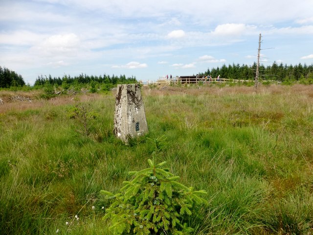
Mynydd Gethin
Parked at the top of the minor road at Ffynnon-y-gôg then used the ENE path to gain access to the hill passing some spoil heaps on my way to the forest. Trig at summit within view of the top of Bike Park Wales. Area also called Mynydd Merthyr.
Name: Mynydd Gethin
Hill number: 2291
Height: 491m / 1611ft
Parent (Ma/M): 2237 Fan Fawr
Section: 32C: Neath to Chepstow
County/UA: Rhondda Cynon Taff (CoU)
Class: Hump, Tump (400-499m), Submarilyn
Grid ref: SO 04424 02518
Summit feature: trig point
Drop: 145m
Col: 346m SO003103
Name: Mynydd Gethin
Hill number: 2291
Height: 491m / 1611ft
Parent (Ma/M): 2237 Fan Fawr
Section: 32C: Neath to Chepstow
County/UA: Rhondda Cynon Taff (CoU)
Class: Hump, Tump (400-499m), Submarilyn
Grid ref: SO 04424 02518
Summit feature: trig point
Drop: 145m
Col: 346m SO003103
 Map © Crown Copyright")
TIP: Click the map for more Large scale mapping
- Grid Square
- SO0402, 15 images (more nearby 🔍)
- Photographer
- Rude Health (more nearby)
- Date Taken
- Friday, 3 July, 2015 (more nearby)
- Submitted
- Wednesday, 8 July, 2015
- Subject Location
-
OSGB36:
 SO 04424 02518 [1m precision]
WGS84: 51:42.7933N 3:23.0867W - Camera Location
-
OSGB36: SO 0443 0251
- View Direction
- West-northwest (about 292 degrees)