2015
TR3142 : Demolition site, 38, London Road
taken 9 years ago, near to Buckland, Kent, England
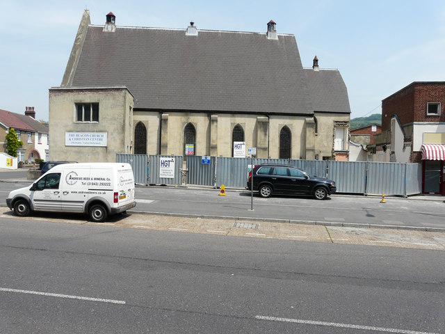
Demolition site, 38, London Road
Compared with TR3142 : Footprints @ The Beacon, London Road, the single-storey building to its left has been demolished. Planning permission has been granted by Dover District Council under application number DOV/13/00790 for alterations to existing shop fronts and erection of a first floor extension to form a guest room and associated external alterations.
 Map © Crown Copyright")
TIP: Click the map for more Large scale mapping
- Grid Square
- TR3142, 234 images (more nearby 🔍)
- Photographer
- John Baker (more nearby)
- Date Taken
- Friday, 12 June, 2015 (more nearby)
- Submitted
- Sunday, 12 July, 2015
- Subject Location
-
OSGB36:
 TR 3123 4215 [10m precision]
WGS84: 51:7.9151N 1:18.2156E - Camera Location
-
OSGB36: TR 3122 4214
- View Direction
- Northeast (about 45 degrees)