2015
SD8578 : Barn above Cosh House
taken 9 years ago, near to Foxup, North Yorkshire, England
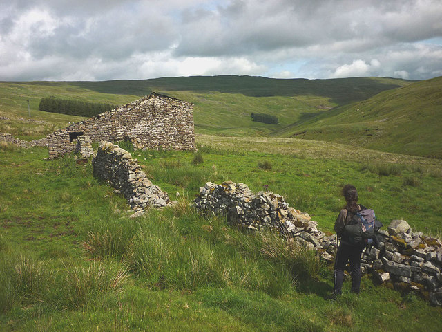
Barn above Cosh House
The track above Cosh House passes by this old barn as it heads towards the moorland surrounding Cosh Beck Head. A quick glance inside suggested that cattle use it as a shelter. Beyond, the deepening valley of Cosh Beck leads out of sight to join Foxup Beck thus forming the River Skirfare in Littondale.
 Map © Crown Copyright")
TIP: Click the map for more Large scale mapping
- Grid Square
- SD8578, 10 images (more nearby 🔍)
- Photographer
- Karl and Ali (more nearby)
- Date Taken
- Sunday, 12 July, 2015 (more nearby)
- Submitted
- Monday, 13 July, 2015
- Subject Location
-
OSGB36:
 SD 8551 7803 [10m precision]
WGS84: 54:11.8691N 2:13.4160W - Camera Location
-
OSGB36: SD 8548 7803
- View Direction
- EAST (about 90 degrees)