2015
SN4562 : Aberaeron Harbour
taken 9 years ago, near to Aberaeron, Ceredigion/Sir Ceredigion, Wales
This is 1 of 45 images, with title Aberaeron Harbour in this square
Aberaeron Harbour
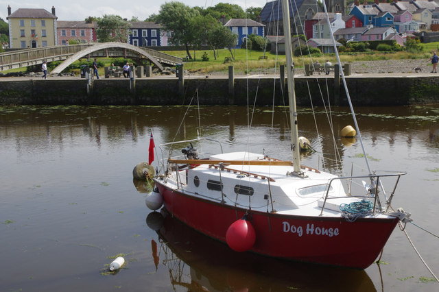
'Dog House' sits in the inner harbour with a backdrop of the multi-coloured houses characteristic of the town.
Aberaeron Harbour
Aberaeron's harbour was built between 1807 and 1811 by the Revd. Alban Thomas Jones Gwynne who had ambitious plans for a new town and port. The town's heyday was in the 19th century when, as well as the activity around the harbour, a significant shipbuilding industry was developed. That has long gone, but the legacy of Revd. Gwynne's vision is an attractive town with a thriving tourism industry.
 Map © Crown Copyright")
TIP: Click the map for more Large scale mapping
- Grid Square
- SN4562, 405 images (more nearby 🔍)
- Photographer
- Stephen McKay (more nearby)
- Date Taken
- Sunday, 12 July, 2015 (more nearby)
- Submitted
- Sunday, 19 July, 2015
- Subject Location
-
OSGB36:
 SN 4570 6292 [10m precision]
WGS84: 52:14.5665N 4:15.6816W - Camera Location
-
OSGB36: SN 4570 6294
- View Direction
- South-southeast (about 157 degrees)