2015
HY6740 : Hammerbrake Farm
taken 9 years ago, near to Sanday Airport, Sanday, Orkney Islands, Scotland
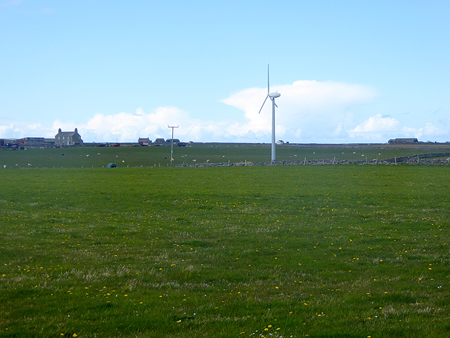
Hammerbrake Farm
Wint turbine in the foreground. Sanday airfield lies beyond the farm.
 Map © Crown Copyright")
TIP: Click the map for more Large scale mapping
- Grid Square
- HY6740, 11 images (more nearby 🔍)
- Photographer
- Oliver Dixon (more nearby)
- Date Taken
- Friday, 8 May, 2015 (more nearby)
- Submitted
- Monday, 20 July, 2015
- Subject Location
-
OSGB36:
 HY 6746 4040 [10m precision]
WGS84: 59:14.9339N 2:34.3346W - Camera Location
-
OSGB36: HY 67930 40087
- View Direction
- Northwest (about 315 degrees)