2015
NX9719 : Redness Point
taken 9 years ago, near to Whitehaven, Cumbria, England
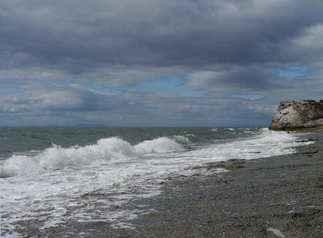
Redness Point
Accessed by a short walk from Whitehaven Harbour, this view near Redness Point also takes in a backdrop of the Kirkcudbrightshire hills across the Solway Firth.
 Map © Crown Copyright")
TIP: Click the map for more Large scale mapping
- Grid Square
- NX9719, 34 images (more nearby 🔍)
- Photographer
- James T M Towill (more nearby)
- Date Taken
- Sunday, 19 July, 2015 (more nearby)
- Submitted
- Tuesday, 21 July, 2015
- Subject Location
-
OSGB36:
 NX 9728 1916 [10m precision]
WGS84: 54:33.4329N 3:35.3928W - Camera Location
-
OSGB36: NX 9728 1916
- View Direction
- NORTH (about 0 degrees)