2015
NZ0802 : Path below Cold Bank
taken 9 years ago, near to Skelton, North Yorkshire, England
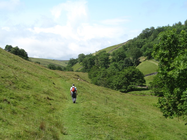
Path below Cold Bank
The path follows the course of Marske Beck towards Helwith. The character of the upper valley is different to that below the junction with Throstle Gill and one wonders if this valley was free of ice or meltwater as it is 'V' shaped and appears not to have been scoured. All guesswork of course.
 Map © Crown Copyright")
TIP: Click the map for more Large scale mapping
- Grid Square
- NZ0802, 30 images (more nearby 🔍)
- Photographer
- Gordon Hatton (more nearby)
- Date Taken
- Sunday, 12 July, 2015 (more nearby)
- Submitted
- Tuesday, 21 July, 2015
- Subject Location
-
OSGB36:
 NZ 0823 0281 [10m precision]
WGS84: 54:25.2398N 1:52.4805W - Camera Location
-
OSGB36: NZ 0828 0283
- View Direction
- West-southwest (about 247 degrees)