2015
SU6719 : Salt Hill reservoir and trig
taken 9 years ago, near to East Meon, Hampshire, England
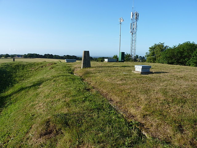
Salt Hill reservoir and trig
OS trig point on the top of the Salt Hill reservoir on Wether Down; it sports flush bracket S1671, which was levelled at 234.388m above Ordnance Datum Newlyn.
 Map © Crown Copyright")
TIP: Click the map for more Large scale mapping
- Grid Square
- SU6719, 79 images (more nearby 🔍)
- Photographer
- Richard Law (more nearby)
- Date Taken
- Saturday, 18 July, 2015 (more nearby)
- Submitted
- Thursday, 23 July, 2015
- Subject Location
-
OSGB36:
 SU 6752 1975 [10m precision]
WGS84: 50:58.3929N 1:2.3823W - Camera Location
-
OSGB36: SU 67522 19775
- View Direction
- SOUTH (about 180 degrees)