2005
SJ9498 : Dukinfield Bridge
taken 19 years ago, near to Ashton-Under-Lyne, Tameside, England
This is 1 of 3 images, with title Dukinfield Bridge in this square
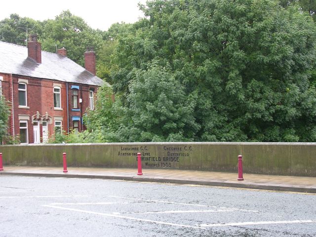
Dukinfield Bridge
This bridge carries Whitelands over the River Tame. The boundary between Ashton-under-Lyne and Dukinfield, and the boundary between Lancashire and Cheshire prior to local government reorganisation in 1974. Taken from SJ94149866.
 Map © Crown Copyright")
TIP: Click the map for more Large scale mapping
- Grid Square
- SJ9498, 273 images (more nearby 🔍)
- Photographer
- Keith Williamson (more nearby)
- Date Taken
- Monday, 29 August, 2005 (more nearby)
- Submitted
- Tuesday, 30 August, 2005
- Subject Location
-
OSGB36:
 SJ 9414 9866 [10m precision]
WGS84: 53:29.0774N 2:5.3866W