2015
SD4255 : Old Hall, Sunderland Point
taken 9 years ago, near to Glasson, Lancashire, England
This is 1 of 3 images, with title starting with Old Hall, Sunderland in this square
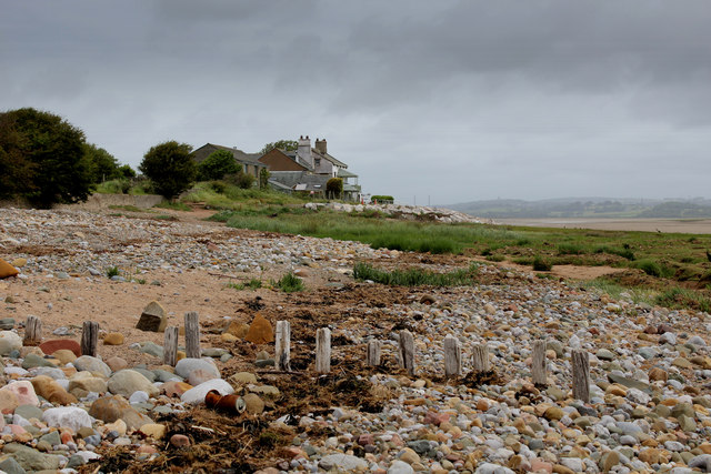
Old Hall, Sunderland Point
Occupies a rather unique and isolated position above the shore line at the point where the Lune Estuary meets Morecambe Bay.
Uninterrupted views across bleak salt marsh and mudflats may not be everybody's cuppa, but I find a certain beauty here.
Uninterrupted views across bleak salt marsh and mudflats may not be everybody's cuppa, but I find a certain beauty here.
 Map © Crown Copyright")
TIP: Click the map for more Large scale mapping
- Grid Square
- SD4255, 81 images (more nearby 🔍)
- Photographer
- Chris Heaton (more nearby)
- Date Taken
- Tuesday, 21 July, 2015 (more nearby)
- Submitted
- Saturday, 25 July, 2015
- Subject Location
-
OSGB36:
 SD 4253 5556 [10m precision]
WGS84: 53:59.5721N 2:52.6839W - Camera Location
-
OSGB36: SD 4251 5550
- View Direction
- North-northeast (about 22 degrees)