2015
NY6519 : Benchmark on building at Jerusalem Farm
taken 9 years ago, near to Colby, Cumbria, England
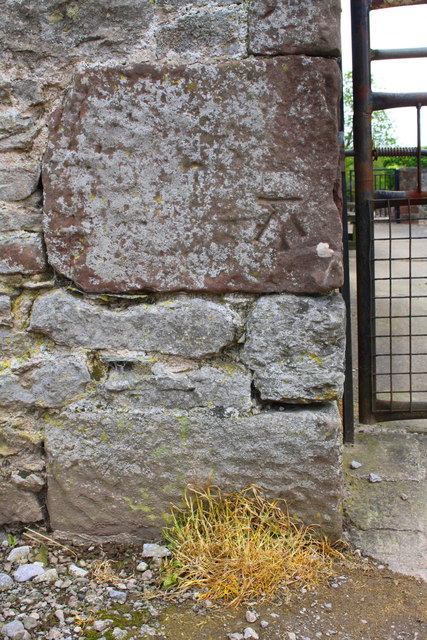
Benchmark on building at Jerusalem Farm
Ordnance Survey cut mark benchmark described on the Bench Mark Database at Link
 Map © Crown Copyright")
TIP: Click the map for more Large scale mapping
- Grid Square
- NY6519, 13 images (more nearby 🔍)
- Photographer
- Roger Templeman (more nearby)
- Date Taken
- Wednesday, 13 May, 2015 (more nearby)
- Submitted
- Tuesday, 28 July, 2015
- Subject Location
-
OSGB36:
 NY 6569 1943 [10m precision]
WGS84: 54:34.1352N 2:31.9310W - Camera Location
-
OSGB36: NY 6569 1943
- View Direction
- East-southeast (about 112 degrees)