2015
SU4700 : Stanswood Bay, disused slipway
taken 9 years ago, near to Calshot, Hampshire, England
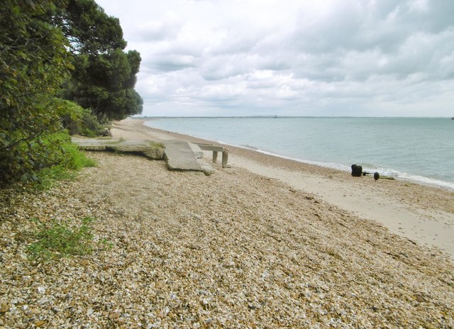
Stanswood Bay, disused slipway
The concrete approach is crumbling, and the winch is on its side.
 Map © Crown Copyright")
TIP: Click the map for more Large scale mapping
- Grid Square
- SU4700, 27 images (more nearby 🔍)
- Photographer
- Mike Faherty (more nearby)
- Date Taken
- Tuesday, 28 July, 2015 (more nearby)
- Submitted
- Tuesday, 28 July, 2015
- Subject Location
-
OSGB36:
 SU 4766 0084 [10m precision]
WGS84: 50:48.3098N 1:19.5001W - Camera Location
-
OSGB36: SU 4765 0083
- View Direction
- Northeast (about 45 degrees)