2015
TQ8209 : Tamarisk Steps, Hastings
taken 9 years ago, near to Hastings, East Sussex, England
This is 1 of 2 images, with title Tamarisk Steps, Hastings in this square
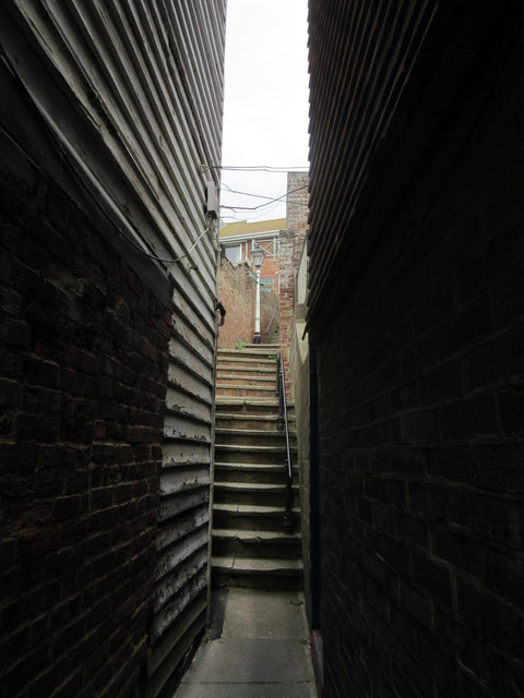
Tamarisk Steps, Hastings
This set of steps and alleyways, is part of a footpath from Rock-a-nore Road, leading up to Tackleway (road).
 Map © Crown Copyright")
TIP: Click the map for more Large scale mapping
- Grid Square
- TQ8209, 4355 images (more nearby 🔍)
- Photographer
- David Anstiss (more nearby)
- Date Taken
- Tuesday, 28 July, 2015 (more nearby)
- Submitted
- Friday, 31 July, 2015
- Subject Location
-
OSGB36:
 TQ 8264 0951 [10m precision]
WGS84: 50:51.3757N 0:35.6137E - Camera Location
-
OSGB36: TQ 8263 0950
- View Direction
- North-northeast (about 22 degrees)