2015
SE0360 : B6160 from Burnsall
taken 9 years ago, near to Burnsall, North Yorkshire, England
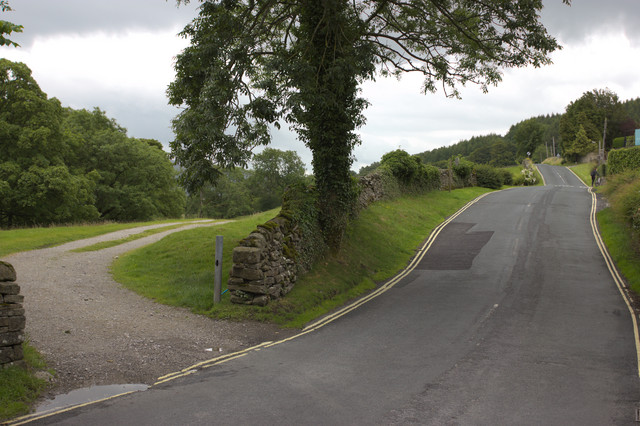
B6160 from Burnsall
On the left is the track to the water treatment works. Old maps show a bench mark on the right side of the entrance, but I could not find this. I think that there may once have been stone gateposts which were removed to widen the entrance.
 Map © Crown Copyright")
TIP: Click the map for more Large scale mapping
- Grid Square
- SE0360, 76 images (more nearby 🔍)
- Photographer
- Mark Anderson (more nearby)
- Date Taken
- Saturday, 1 August, 2015 (more nearby)
- Submitted
- Saturday, 1 August, 2015
- Subject Location
-
OSGB36:
 SE 0317 6094 [10m precision]
WGS84: 54:2.6653N 1:57.1849W - Camera Location
-
OSGB36: SE 0316 6096
- View Direction
- Southeast (about 135 degrees)