2015
SK2861 : Old water source at Upper Hackney
taken 9 years ago, near to Upper Hackney, Derbyshire, England
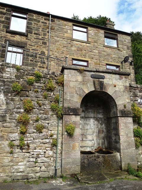
Old water source at Upper Hackney
By the junction of Hackney Road with Ameycroft Lane. For another picture taken in 2008, see Link
 Map © Crown Copyright")
TIP: Click the map for more Large scale mapping
- Grid Square
- SK2861, 49 images (more nearby 🔍)
- Photographer
- Neil Theasby (more nearby)
- Date Taken
- Saturday, 1 August, 2015 (more nearby)
- Submitted
- Saturday, 1 August, 2015
- Subject Location
-
OSGB36:
 SK 2882 6197 [10m precision]
WGS84: 53:9.2454N 1:34.2293W - Camera Location
-
OSGB36: SK 2882 6197
- View Direction
- East-northeast (about 67 degrees)