2015
SE0401 : Eastern End of Chew Reservoir
taken 9 years ago, near to Blindstones [other Features], Oldham, Great Britain
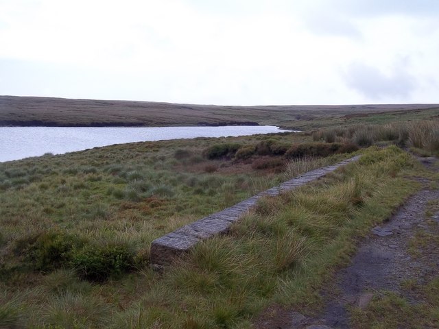
Eastern End of Chew Reservoir
The eastern tongue (at nearly 500m) of what must surely be one of the most remote reservoirs in England.
 Map © Crown Copyright")
TIP: Click the map for more Large scale mapping
- Grid Square
- SE0401, 33 images (more nearby 🔍)
- Photographer
- Jonathan Clitheroe (more nearby)
- Date Taken
- Saturday, 1 August, 2015 (more nearby)
- Submitted
- Sunday, 2 August, 2015
- Subject Location
-
OSGB36:
 SE 0423 0188 [10m precision]
WGS84: 53:30.8150N 1:56.2609W - Camera Location
-
OSGB36: SE 0411 0181
- View Direction
- East-northeast (about 67 degrees)