TQ3313 : At the Ditchling Beacon trig
taken 9 years ago, near to Westmeston, East Sussex, England
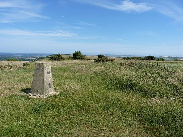
Ditchling Beacon is the third-highest point on the South Downs in south-east England. It consists of a large chalk hill with a particularly steep northern face, covered with open grassland and sheep-grazing areas. Situated just south of the East Sussex village of Ditchling and to the north-east of the city of Brighton, it is the highest point in the county of East Sussex.
more detail from Wikipedia: Link
The South Downs Way is a long distance footpath in Southern England and is one of Britain's National Trails. It runs for around 100 miles from Winchester in Hampshire to Eastbourne in Sussex, with a small loop around Eastbourne. The South Downs Way passes through the South Downs, a beautiful area which is now a National Park. The path mainly follows old routes and droveways along the Chalk escarpment. The majority of the path is a bridleway and so can be used by horse-riders and cyclists too.
More information is available from Link
 Map © Crown Copyright")
- Grid Square
- TQ3313, 217 images (more nearby 🔍)
- Photographer
- Richard Law (more nearby)
- Date Taken
- Saturday, 18 July, 2015 (more nearby)
- Submitted
- Monday, 3 August, 2015
- Subject Location
-
OSGB36:
 TQ 3317 1306 [10m precision]
WGS84: 50:54.1000N 0:6.4516W - Camera Location
-
OSGB36: TQ 33158 13071
- View Direction
- East-southeast (about 112 degrees)