2015

SE7112 : Maud's Bridge

taken 9 years ago, 4 km ESE of Thorne, Doncaster, England

This is 1 of 5 images, with title Maud's Bridge in this square
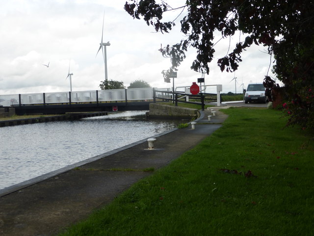
Maud's Bridge
Maud's Bridge
A swing bridge carrying a minor road across the Stainforth & Keadby Canal. Some of the 22 turbines of the Tween Bridge windfarm are on the far bank of the canal.

Creative Commons Licence [Some Rights Reserved]   © Copyright Graham Hogg and licensed for reuse under this Creative Commons Licence.
Geographical Context: Energy infrastructure Roads, Road transport Canals Place: Thorne Primary Subject: Bridge other tags: Windfarm Stainforth & Keadby Canal Click a tag, to view other nearby images.
This photo is linked from: Automatic Clusters: · Maud's Bridge [22] · Stainforth and Keadby Canal at Maud's Bridge [10] · Bank of the Canal [3] · Swing Bridge [2] · Tween Bridge Windfarm [2] Other Photos: · Weak bridge ahead Title Clusters: · Maud's Bridge [5] ·
1:50,000 Modern Day Landranger(TM) Map © Crown Copyright
+
+
1:50,000 Modern Day Landranger(TM) Map © Crown Copyright
TIP: Click the map for more Large scale mapping
Grid Square
SE7112, 39 images   (more nearby 🔍)
Photographer
Graham Hogg   (more nearby)
Date Taken
Tuesday, 28 July, 2015   (more nearby)
Submitted
Monday, 3 August, 2015
Subject Location
OSGB36: geotagged! SE 7182 1219 [10m precision]
WGS84: 53:36.0818N 0:54.9701W
Camera Location
OSGB36: geotagged! SE 7177 1216
View Direction
East-northeast (about 67 degrees)
Clickable map
+
NW N NE
W Go E
SW S SE
Image classification(about): Geograph
This page has been viewed about 53 times
You are not logged in login | register