2015
SE1937 : Calverley Cutting Bridge
taken 9 years ago, near to Calverley, Leeds, England
This is 1 of 8 images, with title starting with Calverley Cutting in this square
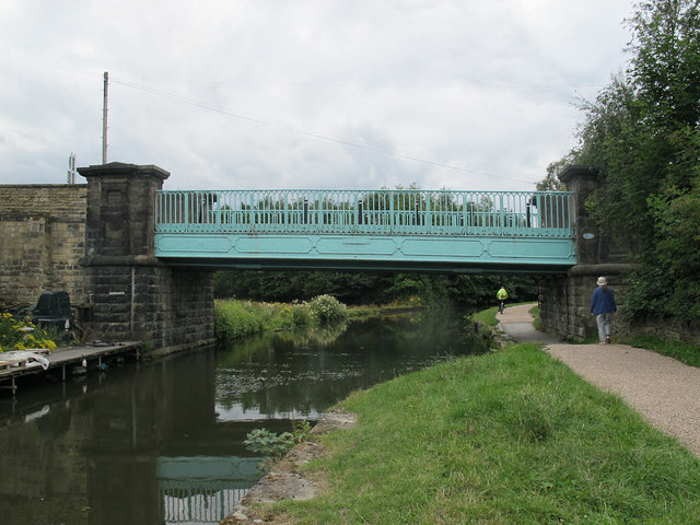
Calverley Cutting Bridge
The "Cutting" SE1937 : Calverley Cutting is a lane running in a straight line down the hill from Calverley village to Apperley Bridge. Now it is a byway. According to Dr Neil Clifton SE1937 : View from Thornhill Bridge 214B, Leeds and Liverpool Canal the current bridge was built "in the late 1930s".
 Map © Crown Copyright")
TIP: Click the map for more Large scale mapping
- Grid Square
- SE1937, 392 images (more nearby 🔍)
- Photographer
- Stephen Craven (more nearby)
- Date Taken
- Friday, 31 July, 2015 (more nearby)
- Submitted
- Sunday, 9 August, 2015
- Subject Location
-
OSGB36:
 SE 1963 3771 [10m precision]
WGS84: 53:50.1167N 1:42.1920W - Camera Location
-
OSGB36: SE 1964 3773
- View Direction
- South-southwest (about 202 degrees)