2015
SJ6886 : Lymm Dam and St Mary the Virgin, Lymm
taken 9 years ago, near to Lymm, Warrington, England
This is 1 of 10 images, with title starting with Lymm Dam in this square
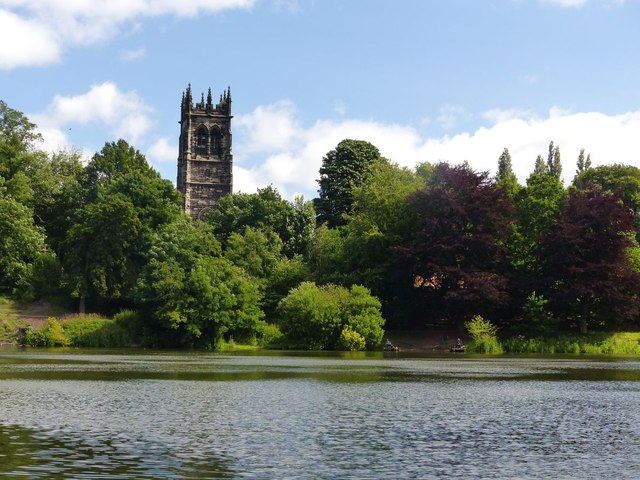
Lymm Dam and St Mary the Virgin, Lymm
Classic view of the church across Lymm Dam. The lake was former by the damming of the Sow Brook to build a turnpike road (now the A56).
 Map © Crown Copyright")
TIP: Click the map for more Large scale mapping
- Grid Square
- SJ6886, 55 images (more nearby 🔍)
- Photographer
- Dave Dunford (more nearby)
- Date Taken
- Thursday, 30 July, 2015 (more nearby)
- Submitted
- Thursday, 13 August, 2015
- Subject Location
-
OSGB36:
 SJ 6825 8681 [10m precision]
WGS84: 53:22.6310N 2:28.7233W - Camera Location
-
OSGB36: SJ 6807 8690
- View Direction
- East-southeast (about 112 degrees)