2009
SP9111 : Weavers Road, Tring
taken 15 years ago, near to Tring, Hertfordshire, England
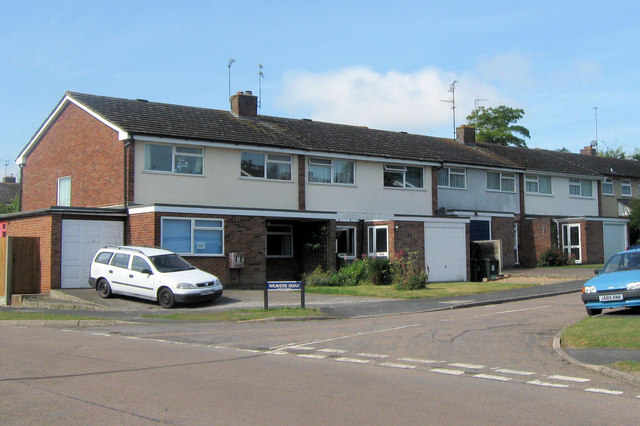
Weavers Road, Tring
Weavers Road is a cul-de-sac with three pairs of semi-detached houses on each side. One house has converted the original garage to a room, and built a garage on the side. Most properties on the estate do not have sufficient room for this to happen.
Buckingham Road Area, Tring
Buckingham Road is off Miswell Lane, and the East end of the road was formerly the site of the Red House, Miswell Lane, and its gardens. The first part of the estate (odd 1-33, even 2-10), plus Weavers Roar and Anns Close, were built in the late 1960s. The houses were all three or four bed roomed, mostly semi-detached - but with some 5 house terraces.
The west end of the road, Oakley Lane, Fairthorn Close, and the west end of Highfield Road were built around 1970. These houses were somewhat smaller terraced houses, many with garages in separate blocks. Some of the houses in Oakley Lane and Fairthorn Close have no direct frontage onto the road.
 Map © Crown Copyright")
TIP: Click the map for more Large scale mapping
- Grid Square
- SP9111, 109 images (more nearby 🔍)
- Photographer
- Chris Reynolds (more nearby)
- Date Taken
- Friday, 11 September, 2009 (more nearby)
- Submitted
- Friday, 14 August, 2015
- Subject Location
-
OSGB36:
 SP 9142 1151 [10m precision]
WGS84: 51:47.6868N 0:40.5477W - Camera Location
-
OSGB36: SP 9146 1150
- View Direction
- West-northwest (about 292 degrees)