2015
NS8510 : Sheep fold, in the Mennock Pass
taken 9 years ago, 3 km from Auchengruith, Dumfries And Galloway, Scotland
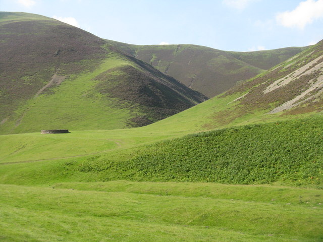
Sheep fold, in the Mennock Pass
On a ridge between the Beer Burn and the main valley of the Mennock Water. The maps marks in old script a 'Cross' or 'Earthen Cross' depending on the scale. It is not very obvious, especially if one is expecting the usual stone cross, but Mary and Angus Hogg did some detective work and discovered it about 20m east of the sheepfold NS8510 : Mennock Earthen Cross. It does show up quite well on Google Earth imagery of 2010, with the help of a slight shadow from the morning sun.
 Map © Crown Copyright")
TIP: Click the map for more Large scale mapping
- Grid Square
- NS8510, 53 images (more nearby 🔍)
- Photographer
- M J Richardson (more nearby)
- Date Taken
- Thursday, 13 August, 2015 (more nearby)
- Submitted
- Saturday, 15 August, 2015
- Subject Location
-
OSGB36:
 NS 8502 1051 [10m precision]
WGS84: 55:22.5037N 3:48.9608W - Camera Location
-
OSGB36: NS 8507 1032
- View Direction
- North-northwest (about 337 degrees)