2015
NS8610 : Wee Black Carli
taken 9 years ago, 3 km from Wanlockhead, Dumfries And Galloway, Scotland
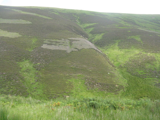
Wee Black Carli
A tributary of the Mennock Water on the west slope of East Mount Lowther. 'carli', as a word for a watercourse, is not one I have come across, but there are several near here NS8609 : Wee Black Carli, Big Black Carli and Green Carli. It is not in the on-line Scots dictionary.
 Map © Crown Copyright")
TIP: Click the map for more Large scale mapping
- Grid Square
- NS8610, 20 images (more nearby 🔍)
- Photographer
- M J Richardson (more nearby)
- Date Taken
- Thursday, 13 August, 2015 (more nearby)
- Submitted
- Saturday, 15 August, 2015
- Subject Location
-
OSGB36:
 NS 8684 1001 [10m precision]
WGS84: 55:22.2597N 3:47.2264W - Camera Location
-
OSGB36: NS 8667 1011
- View Direction
- East-southeast (about 112 degrees)