2015
TR2548 : Signalling at Shepherdswell
taken 9 years ago, near to Shepherdswell or Sibertswold, Kent, England
Signalling at Shepherdswell
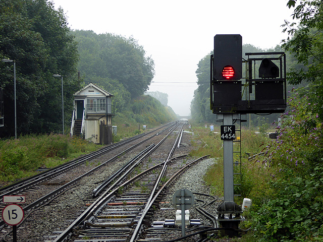
The station is called 'Shepherdswell' but the signal box is 'Shepherds Well'. The OS have it as 'Shepherdswell or Sibertswold'. The signal box is now closed but is protected by grade II listing. It dates from c1878 and was built by the London, Chatham & Dover Railway. As denoted on the colour light signal, this route is now controlled by the East Kent signalling centre, which is at Gillingham. Although the siding is connected and fully signalled, it appears not to have had much use of late!
 Map © Crown Copyright")
TIP: Click the map for more Large scale mapping
- Grid Square
- TR2548, 238 images (more nearby 🔍)
- Photographer
- John Lucas (more nearby)
- Date Taken
- Thursday, 13 August, 2015 (more nearby)
- Submitted
- Sunday, 16 August, 2015
- Subject Location
-
OSGB36:
 TR 2576 4820 [10m precision]
WGS84: 51:11.3048N 1:13.7603E - Camera Location
-
OSGB36: TR 25783 48193
- View Direction
- Northwest (about 315 degrees)