2015
SE5086 : Towards Cleave Dyke Quarry
taken 9 years ago, near to Boltby, North Yorkshire, England
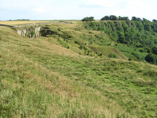
Towards Cleave Dyke Quarry
The face of the disused quarry is obvious just below the scarp top, but the other hummocky ground poses some questions as to which areas are quarry spoil [there is one very obvious flat topped spoil heap centre right] and which are natural slippage.
 Map © Crown Copyright")
TIP: Click the map for more Large scale mapping
- Grid Square
- SE5086, 44 images (more nearby 🔍)
- Photographer
- Gordon Hatton (more nearby)
- Date Taken
- Monday, 17 August, 2015 (more nearby)
- Submitted
- Monday, 17 August, 2015
- Subject Location
-
OSGB36:
 SE 5065 8628 [10m precision]
WGS84: 54:16.1805N 1:13.4270W - Camera Location
-
OSGB36: SE 5068 8646
- View Direction
- SOUTH (about 180 degrees)