2015
SH8923 : A line of exposed peat on Foel Rhudd
taken 9 years ago, 3 km from Ty-Nant, Gwynedd, Wales
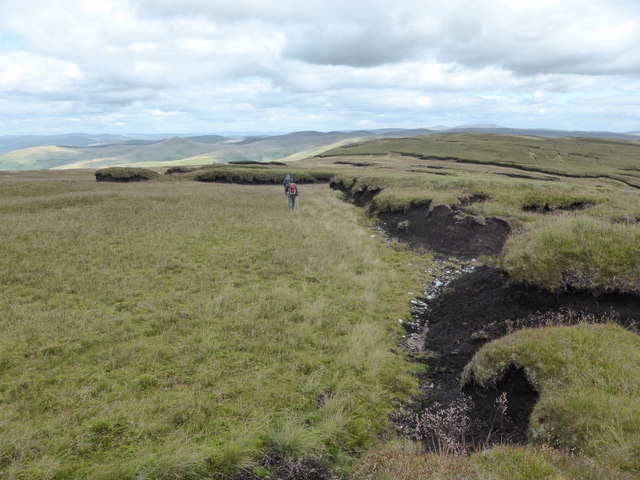
A line of exposed peat on Foel Rhudd
Some of the white quartz, as used in the summit cairns, can be seen below the peat.
 Map © Crown Copyright")
TIP: Click the map for more Large scale mapping
- Grid Square
- SH8923, 20 images (more nearby 🔍)
- Photographer
- David Medcalf (more nearby)
- Date Taken
- Saturday, 15 August, 2015 (more nearby)
- Submitted
- Monday, 17 August, 2015
- Subject Location
-
OSGB36:
 SH 8925 2381 [10m precision]
WGS84: 52:48.0265N 3:38.6493W - Camera Location
-
OSGB36: SH 8915 2376
- View Direction
- East-northeast (about 67 degrees)