NZ2563 : 57 Quayside
taken 9 years ago, near to Gateshead, England
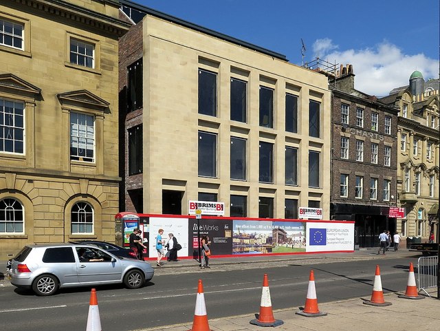
The new building is separated from The Customs House (left) by the narrow passage of Trinity Chare.
Chares is a Geordie word used for the narrow alley-ways in Newcastle. There used to be about 20 chares which led back from the Quayside in the medieval town (Dark Chare, Grindon Chare, Blue Anchor Chare, Peppercorn Chare, Palester Chare, Colvin's Chare, Hornsby Chare, Plumber Chare, Fenwick's Chare, Dark Chare, Broad Garth, Peacock Chare, Trinity Chare, Rewcastle Chare, Broad Chare, Spicer Lane, Burn Bank, Byker Chare, Cock's Chare and Love Lane).
The name was also applied to narrow lanes in different parts of the city and other parts of Northumberland Link
On the Quayside, they are thought to have arisen from wooden piers built out into the river, between which rubbish was dumped and houses built on the reclaimed land.
The buildings alongside the chares were crowded and unpleasant. Many were destroyed in the great fire of 1854 NZ2563 : Hillgate explosion, vividly illustrated in 'View from the High Level Bridge' by M. & M. W. Lambert (1854) Link
Broad Chare was so called as it was wide enough for a cart, the others were much narrower Link
Wikipedia: Link
The present state of Newcastle: Streets within the walls by Eneas Mackenzie (1827) Link
Plan of Newcastle upon Tyne and Gateshead by John Wood (1827) Link
Tyne and Wear HER(1596): Newcastle, Quayside (The Key) Link
Tyne and Wear HER(11101): Newcastle, medieval town Link
 Map © Crown Copyright")
- Grid Square
- NZ2563, 2029 images (more nearby 🔍)
- Photographer
- Andrew Curtis (more nearby)
- Date Taken
- Wednesday, 19 August, 2015 (more nearby)
- Submitted
- Wednesday, 19 August, 2015
- Subject Location
-
OSGB36:
 NZ 2541 6391 [10m precision]
WGS84: 54:58.1501N 1:36.2772W - Camera Location
-
OSGB36: NZ 25412 63891
- View Direction
- North-northeast (about 22 degrees)