2015
SN7553 : Drovers' road climbing from Cwm Doethie, Ceredigion
taken 9 years ago, near to Ty'n-y-Cornel [other Features], Ceredigion, Great Britain
This is 1 of 4 images, with title Drovers' road climbing from Cwm Doethie, Ceredigion in this square
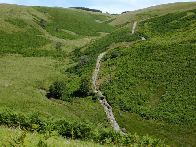
Drovers' road climbing from Cwm Doethie, Ceredigion
This image taken from the lower slopes of Gouallt reveals the extent of the severe erosion which has caused the full closure of the route from early 2014 until at least late 2015. As can be seen, no repairs have been done here, though some maintenance is being carried out towards Soar-y-Mynydd where the need is probably less acute!
SN7553 : Cwm Doethie byway erosion, Ceredigion
SN7553 : Cwm Doethie byway erosion, Ceredigion
 Map © Crown Copyright")
TIP: Click the map for more Large scale mapping
- Grid Square
- SN7553, 345 images (more nearby 🔍)
- Photographer
- Roger D Kidd (more nearby)
- Date Taken
- Tuesday, 18 August, 2015 (more nearby)
- Submitted
- Monday, 24 August, 2015
- Subject Location
-
OSGB36:
 SN 7569 5335 [10m precision]
WGS84: 52:9.8626N 3:49.1321W - Camera Location
-
OSGB36: SN 7542 5326
- View Direction
- East-northeast (about 67 degrees)