2015
TQ8055 : Redevelopment of Caterways, Church Lane, Bearsted
taken 9 years ago, near to Bearsted, Kent, England
This is 1 of 2 images, with title Redevelopment of Caterways, Church Lane, Bearsted in this square
Redevelopment of Caterways, Church Lane, Bearsted
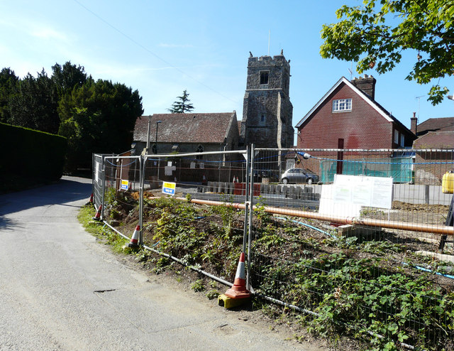
Planning permission has been granted by Maidstone Borough Council under application number 14/506788/FULL for the demolition of existing house and erection of replacement 3 bedroom dwelling (Amended proposal following previous refusal 14/503970/FULl) as shown on Plan numbers 1636.IM.201, 1636.P.201, 1636.P.202, 1636.P.203, 1636.P.204. Design and Access Statement and Application Form received 23 December 2014. The church of Holy Cross lies beyond.
 Map © Crown Copyright")
TIP: Click the map for more Large scale mapping
- Grid Square
- TQ8055, 107 images (more nearby 🔍)
- Photographer
- John Baker (more nearby)
- Date Taken
- Sunday, 9 August, 2015 (more nearby)
- Submitted
- Thursday, 27 August, 2015
- Subject Location
-
OSGB36:
 TQ 8011 5555 [10m precision]
WGS84: 51:16.2382N 0:34.8336E - Camera Location
-
OSGB36: TQ 8010 5557
- View Direction
- SOUTH (about 180 degrees)