2015
NY7521 : Lowfield Hush
taken 9 years ago, near to Hilton, Cumbria, England
This is 1 of 2 images, with title starting with Lowfield in this square
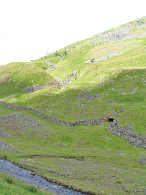
Lowfield Hush
A deep trench carved into the fellside by miners searching for galena [lead sulphide]. This feature appears to date back to at least the 18thC and is the result of repeated diggings and washing through with water to expose the mineral veins. What appears to be a level entrance at the base of the hush is actually the remains of an old lime kiln.
 Map © Crown Copyright")
TIP: Click the map for more Large scale mapping
- Grid Square
- NY7521, 14 images (more nearby 🔍)
- Photographer
- Gordon Hatton (more nearby)
- Date Taken
- Sunday, 30 August, 2015 (more nearby)
- Submitted
- Monday, 31 August, 2015
- Subject Location
-
OSGB36:
 NY 7530 2163 [10m precision]
WGS84: 54:35.3552N 2:23.0242W - Camera Location
-
OSGB36: NY 7553 2167
- View Direction
- WEST (about 270 degrees)