2005
SD9619 : Footpaths and waymarker, Light Hazzles Reservoir
taken 19 years ago, near to Summit, Rochdale, England
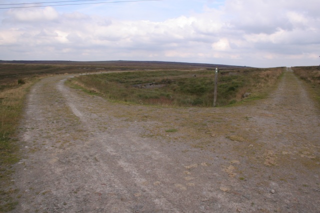
Footpaths and waymarker, Light Hazzles Reservoir
Looking NE with the Pennine Way to the left and footpath to White Holme Reservoir on the right. The low ground between is the southern tip of Light Hazzles Reservoir.
 Map © Crown Copyright")
TIP: Click the map for more Large scale mapping
- Grid Square
- SD9619, 92 images (more nearby 🔍)
- Photographer
- Mark Anderson (more nearby)
- Date Taken
- Tuesday, 30 August, 2005 (more nearby)
- Submitted
- Tuesday, 30 August, 2005
- Subject Location
-
OSGB36:
 SD 962 194 [100m precision]
WGS84: 53:40.2636N 2:3.5396W