TM3295 : Spectators at the Seething Charity Air Day
taken 9 years ago, near to Thwaite st Mary, Norfolk, England
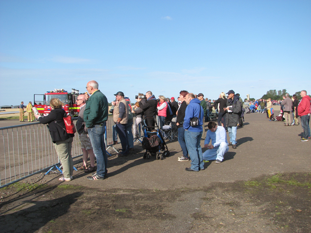
A Charity Air Day is organised every year with the aim to raise as much money as possible for chosen charities, the East Anglian Air Ambulance and East Anglia's Children's Hospice and to provide a platform for local charitable organisations on which to promote their cause. It is also a good day out for young and old. The Seething Control Tower Museum, housed in the restored Second World Ward watch office, is also open to visitors.
Built by John Laing & Sons in 1942/43 to the standard Class A requirement for heavy bombers, Seething airfield was initially known as RAF 258 Seething. After the arrival of the United States Army Air Forces Eighth Air Force 448th Bombardment Group (Heavy) it became USAAF Station 146.
After the last Americans had left in June/July 1945, the airfield was used for storing bombs and munitions. In 1947, part of the buildings on the Hospital site were converted into temporary dwellings and most of the land was returned to agriculture. The eastern section, including part of the main runway, is currently Seething Airfield, home to the Waveney Flying Group. The former Control tower has since been restored and now houses a memorial museum. The Seething Control Tower Museum is open on the first Sunday of the month from May to October. Link.
See also: Link
 Map © Crown Copyright")
- Grid Square
- TM3295, 73 images (more nearby 🔍)
- Photographer
- Evelyn Simak (more nearby)
- Date Taken
- Sunday, 6 September, 2015 (more nearby)
- Submitted
- Monday, 7 September, 2015
- Subject Location
-
OSGB36:
 TM 3217 9573 [10m precision]
WGS84: 52:30.5990N 1:25.1949E - Camera Location
-
OSGB36: TM 3205 9564
- View Direction
- Northeast (about 45 degrees)