2015
SU3401 : Cycle route, Hawkhill Inclosure
taken 9 years ago, near to Furzey Lodge, Hampshire, England
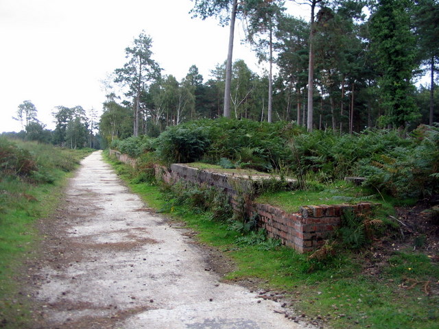
Cycle route, Hawkhill Inclosure
The station platform-like structure to the right of the track was (according to the interpretation panel mounted on the brickwork) a WWII bomb preparation area for RAF Beaulieu. A second similar structure stands a short distance away to the north-east, at SU350021.
See other images of Cycle routes in the New Forest
 Map © Crown Copyright")
TIP: Click the map for more Large scale mapping
- Grid Square
- SU3401, 55 images (more nearby 🔍)
- Photographer
- E Gammie (more nearby)
- Date Taken
- Saturday, 5 September, 2015 (more nearby)
- Submitted
- Tuesday, 8 September, 2015
- Subject Location
-
OSGB36:
 SU 349 019 [100m precision]
WGS84: 50:48.9683N 1:30.3156W - Camera Location
-
OSGB36: SU 349 019
- View Direction
- North-northeast (about 22 degrees)