2015
NY0404 : Sellafield from the air
taken 9 years ago, near to Calder Bridge, Cumbria, England
This is 1 of 2 images, with title Sellafield from the air in this square
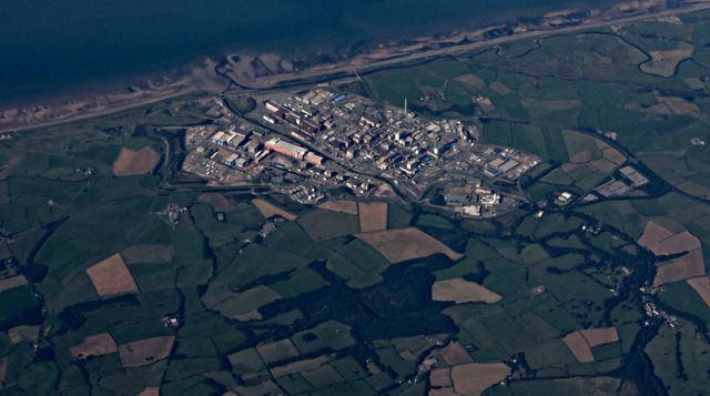
Sellafield from the air
To folk of my generation, it will always be known as Windscale. Wikipedia Link .
.
Lingbank Plantation is in the foreground.
See also NY0404 : Sellafield from the air.
Lingbank Plantation is in the foreground.
See also NY0404 : Sellafield from the air.
 Map © Crown Copyright")
TIP: Click the map for more Large scale mapping
- Grid Square
- NY0404, 4 images (more nearby 🔍)
- Photographer
- Thomas Nugent (more nearby)
- Date Taken
- Monday, 31 August, 2015 (more nearby)
- Submitted
- Tuesday, 8 September, 2015
- Subject Location
-
OSGB36:
 NY 04 04 [1000m precision]
WGS84: 54:25.6156N 3:28.4120W - View Direction
- West-southwest (about 247 degrees)