2015
SJ4065 : Old Dee Bridge - Chester
taken 9 years ago, near to Handbridge, Cheshire West And Chester, England
This is 1 of 21 images, with title starting with Old Dee Bridge in this square
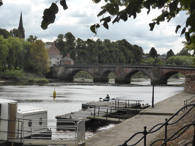
Old Dee Bridge - Chester
Masonry bridge of the 14th century built by Henry de Snedlleston - mason and surveyor to Edward the Black Prince. Five arches - only four seen here.
 Map © Crown Copyright")
TIP: Click the map for more Large scale mapping
- Grid Square
- SJ4065, 1383 images (more nearby 🔍)
- Photographer
- Chris Allen (more nearby)
- Date Taken
- Friday, 4 September, 2015 (more nearby)
- Submitted
- Wednesday, 9 September, 2015
- Subject Location
-
OSGB36:
 SJ 4069 6579 [10m precision]
WGS84: 53:11.1529N 2:53.3415W - Camera Location
-
OSGB36: SJ 4072 6586
- View Direction
- South-southwest (about 202 degrees)