2015
TR0827 : Rugby Clubs Campsite, Dymchurch Road, St Marys Bay
taken 9 years ago, near to St Mary's Bay, Kent, England
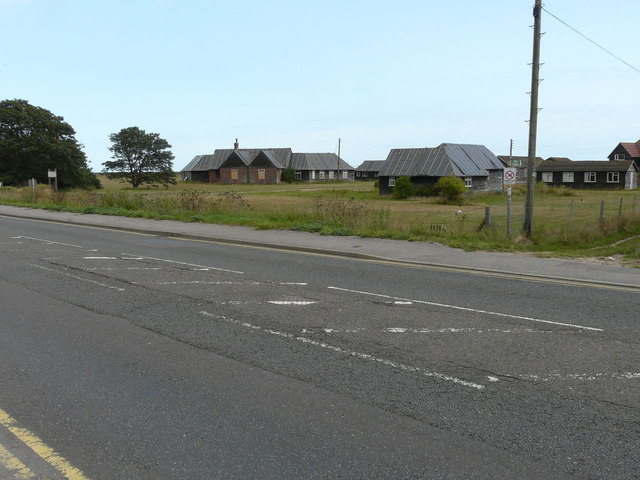
Rugby Clubs Campsite, Dymchurch Road, St Marys Bay
Planning permission has been approved, with conditions, by Folkestone and Hythe District Council under application number Y12/0585/SH for the demolition of existing buildings and structures and construction of a sleeping accommodation block, entrance pavilion, swimming pool building, games hall and gallery and layout of sports pitches and car park with associated landscaping and boundary treatment.
 Map © Crown Copyright")
TIP: Click the map for more Large scale mapping
- Grid Square
- TR0827, 163 images (more nearby 🔍)
- Photographer
- John Baker (more nearby)
- Date Taken
- Sunday, 16 August, 2015 (more nearby)
- Submitted
- Friday, 11 September, 2015
- Subject Location
-
OSGB36:
 TR 0890 2708 [10m precision]
WGS84: 51:0.3099N 0:58.5732E - Camera Location
-
OSGB36: TR 0882 2711
- View Direction
- East-southeast (about 112 degrees)