2015
SP3688 : Pivot benchmark on canal overflow
taken 9 years ago, near to Griff, Warwickshire, England
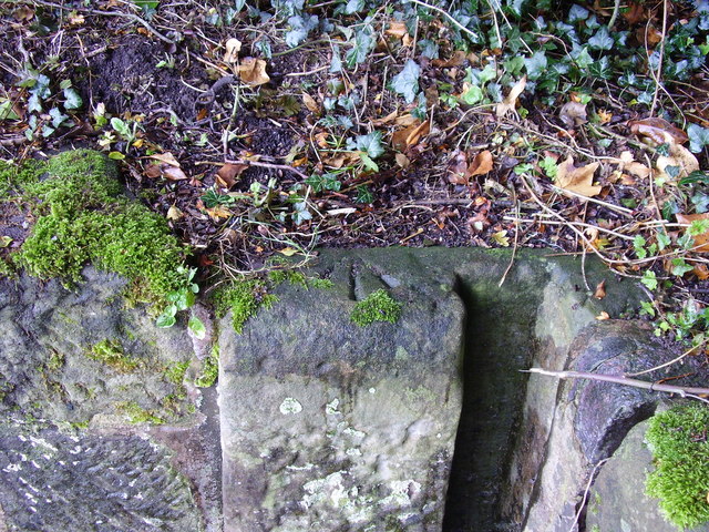
Pivot benchmark on canal overflow
Pivot benchmark on the south corner of Bedworth Mill canal overflow, shown on the 1951 OS map as 303.6ft (92.54m) above mean sea level at Newlyn.
 Map © Crown Copyright")
TIP: Click the map for more Large scale mapping
- Grid Square
- SP3688, 93 images (more nearby 🔍)
- Photographer
- Shantavira (more nearby)
- Date Taken
- Saturday, 12 September, 2015 (more nearby)
- Submitted
- Monday, 14 September, 2015
- Subject Location
-
OSGB36:
 SP 3653 8830 [10m precision]
WGS84: 52:29.4837N 1:27.8050W - Camera Location
-
OSGB36: SP 3653 8830
- View Direction
- Southeast (about 135 degrees)