2015
NY2207 : Boulderfield at northern end of Ill Crag
taken 9 years ago, 4 km E of Wasdale Head, Cumbria, England
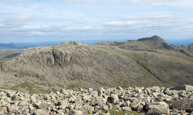
Boulderfield at northern end of Ill Crag
One of the main paths to and from Scafell Pike passes between two satellite tops of the mountain, Broad Crag and Ill Crag. Boulders abound everywhere; those seen here are close to the path as it passes north of Ill Crag. Esk Pike and Bow Fell are the two mountains beyond the boulders.
 Map © Crown Copyright")
TIP: Click the map for more Large scale mapping
- Grid Square
- NY2207, 33 images (more nearby 🔍)
- Photographer
- Trevor Littlewood (more nearby)
- Date Taken
- Saturday, 5 September, 2015 (more nearby)
- Submitted
- Wednesday, 16 September, 2015
- Subject Location
-
OSGB36:
 NY 2246 0779 [10m precision]
WGS84: 54:27.5728N 3:11.8582W - Camera Location
-
OSGB36: NY 2243 0780
- View Direction
- East-southeast (about 112 degrees)