2005
NY6851 : Disused Railway Viaduct, Lintley
taken 19 years ago, near to Slaggyford, Northumberland, England
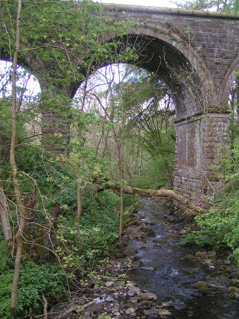
Disused Railway Viaduct, Lintley
Viaduct now carries the South Tyne Trail; viewed from the Pennine Way, which passes underneath.
 Map © Crown Copyright")
TIP: Click the map for more Large scale mapping
- Grid Square
- NY6851, 84 images (more nearby 🔍)
- Photographer
- Dave Dunford (more nearby)
- Date Taken
- Sunday, 29 May, 2005 (more nearby)
- Submitted
- Wednesday, 31 August, 2005
- Subject Location
-
OSGB36:
 NY 686 511 [100m precision]
WGS84: 54:51.2222N 2:29.4361W - Camera Location
-
OSGB36: NY 686 511
- View Direction
- Northeast (about 45 degrees)