2015
NY3226 : Gate Gill
taken 9 years ago, near to Threlkeld, Cumbria, England
This is 1 of 6 images, with title Gate Gill in this square
Gate Gill
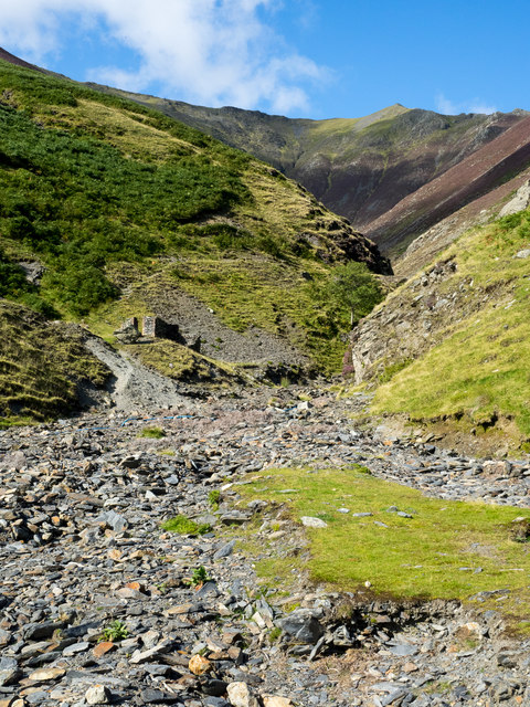
Gate Gill as seen from the weir at the edge of open countryside where a footpath crosses what would usually be the water flow, however as the image was recorded the stream was dry at this location. Gategill Fell rises to the left and Hall's Fell to the right; that ridge rises to Hallsfell Top which is in view and is the summit of Blencathra.
 Map © Crown Copyright")
TIP: Click the map for more Large scale mapping
- Grid Square
- NY3226, 44 images (more nearby 🔍)
- Photographer
- Trevor Littlewood (more nearby)
- Date Taken
- Sunday, 6 September, 2015 (more nearby)
- Submitted
- Sunday, 27 September, 2015
- Subject Location
-
OSGB36:
 NY 3243 2632 [10m precision]
WGS84: 54:37.6483N 3:2.8878W - Camera Location
-
OSGB36: NY 3243 2623
- View Direction
- NORTH (about 0 degrees)