2015
SO2872 : Glyndwr's Way marker stone at the start/end of the path
taken 9 years ago, near to Knighton, Powys, Wales
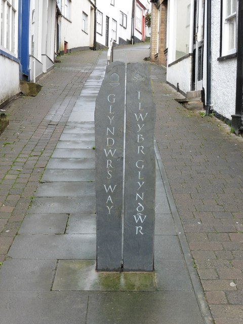
Glyndwr's Way marker stone at the start/end of the path
 Map © Crown Copyright")
TIP: Click the map for more Large scale mapping
- Grid Square
- SO2872, 404 images (more nearby 🔍)
- Photographer
- Dave Kelly (more nearby)
- Date Taken
- Tuesday, 15 September, 2015 (more nearby)
- Submitted
- Sunday, 27 September, 2015
- Subject Location
-
OSGB36:
 SO 2846 7223 [10m precision]
WGS84: 52:20.6076N 3:3.0932W - Camera Location
-
OSGB36: SO 2849 7225
- View Direction
- West-southwest (about 247 degrees)