2015
TQ3978 : Thameside path at Greenwich Peninsula (1)
taken 9 years ago, near to Greenwich, England
Thameside path at Greenwich Peninsula (1)
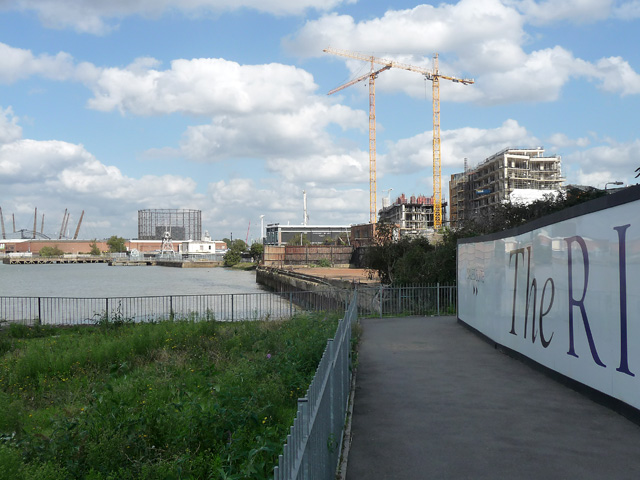
The path on the peninsula's west side gives a taste of the area before gentrification, running as it does between scrappy industrial sites, abandoned concrete blocks, and empty sites all awaiting the tide of re-development which quickly encroaches from the south, east and north (River Gardens is taking shape behind the hoardings).
The gas-holder is off Millennium Way.
The gas-holder is off Millennium Way.
 Map © Crown Copyright")
TIP: Click the map for more Large scale mapping
- Grid Square
- TQ3978, 436 images (more nearby 🔍)
- Photographer
- Stephen Richards (more nearby)
- Date Taken
- Saturday, 26 September, 2015 (more nearby)
- Submitted
- Sunday, 27 September, 2015
- Subject Location
-
OSGB36:
 TQ 3908 7852 [10m precision]
WGS84: 51:29.3119N 0:0.1083E - Camera Location
-
OSGB36: TQ 3906 7849
- View Direction
- Northeast (about 45 degrees)