2015
NU1242 : The Pilgrim's Path, Holy Island
taken 9 years ago, near to Holy Island, Northumberland, England
This is 1 of 5 images, with title starting with The Pilgrim's in this square
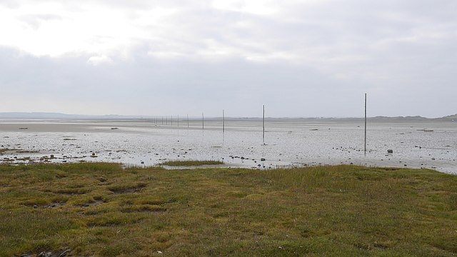
The Pilgrim's Path, Holy Island
Marker posts lead across the sand. There was a rising tide, so we cut across from here to the road near Snook Head rather than taking the direct route.
 Map © Crown Copyright")
TIP: Click the map for more Large scale mapping
- Grid Square
- NU1242, 261 images (more nearby 🔍)
- Photographer
- Richard Webb (more nearby)
- Date Taken
- Sunday, 4 October, 2015 (more nearby)
- Submitted
- Tuesday, 6 October, 2015
- Subject Location
-
OSGB36:
 NU 1231 4257 [10m precision]
WGS84: 55:40.5882N 1:48.3494W - Camera Location
-
OSGB36: NU 1234 4256
- View Direction
- WEST (about 270 degrees)