2015
NY4506 : Upper Kentmere
taken 9 years ago, near to Kentmere, Cumbria, England
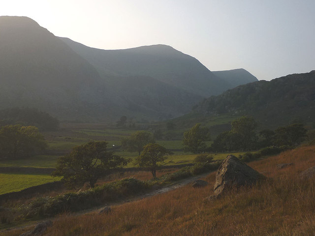
Upper Kentmere
At this time of the year, the sun soon dips behind the range of fells that bound the Kentmere valley. These pastures are the highest in the dale and are about to be cast into shadow.
 Map © Crown Copyright")
TIP: Click the map for more Large scale mapping
- Grid Square
- NY4506, 18 images (more nearby 🔍)
- Photographer
- Karl and Ali (more nearby)
- Date Taken
- Sunday, 4 October, 2015 (more nearby)
- Submitted
- Tuesday, 6 October, 2015
- Subject Location
-
OSGB36:
 NY 4579 0660 [10m precision]
WGS84: 54:27.1131N 2:50.2550W - Camera Location
-
OSGB36: NY 4579 0660
- View Direction
- West-northwest (about 292 degrees)