2015
SE8660 : Chalk pit near Fridaythorpe
taken 9 years ago, near to Fridaythorpe, East Riding of Yorkshire, England
This is 1 of 2 images, with title Chalk pit near Fridaythorpe in this square
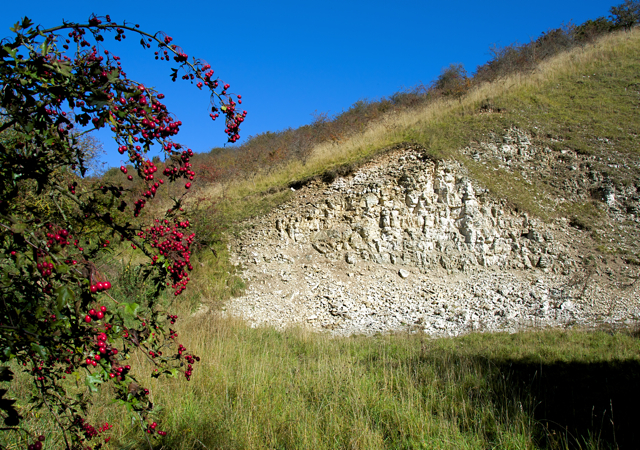
Chalk pit near Fridaythorpe
Small disused pit on the north side of Thixendale Road as it descends into Brubberdale
 Map © Crown Copyright")
TIP: Click the map for more Large scale mapping
- Grid Square
- SE8660, 25 images (more nearby 🔍)
- Photographer
- Paul Harrop (more nearby)
- Date Taken
- Thursday, 8 October, 2015 (more nearby)
- Submitted
- Friday, 9 October, 2015
- Subject Location
-
OSGB36:
 SE 8670 6024 [10m precision]
WGS84: 54:1.8524N 0:40.6710W - Camera Location
-
OSGB36: SE 8670 6022
- View Direction
- NORTH (about 0 degrees)