2015
SP4604 : Benchmark on St Michael's Church
taken 9 years ago, near to Cumnor, Oxfordshire, England
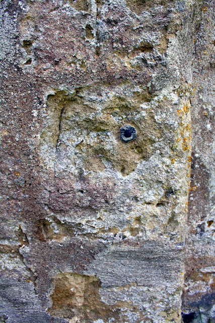
Benchmark on St Michael's Church
Ordnance Survey 1GL bolt benchmark described on the Bench Mark Database at Link
 Map © Crown Copyright")
TIP: Click the map for more Large scale mapping
- Grid Square
- SP4604, 54 images (more nearby 🔍)
- Photographer
- Roger Templeman (more nearby)
- Date Taken
- Friday, 9 October, 2015 (more nearby)
- Submitted
- Saturday, 10 October, 2015
- Subject Location
-
OSGB36:
 SP 4613 0414 [10m precision]
WGS84: 51:44.0448N 1:20.0048W - Camera Location
-
OSGB36: SP 4613 0414
- View Direction
- EAST (about 90 degrees)