2012
TQ2978 : 147-150 Grosvenor Road
taken 12 years ago, near to City of Westminster, England
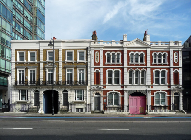
147-150 Grosvenor Road
A handsome pair of survivals from the area's industrial past - they would have been offices or managers' houses serving wharves, reached through the arched carriageways. The showier example on the right, by F.G. Widdows, dates from c1870 and was built for Fabricotti's marble works (TQ2978 : Detail of 147-148 Grosvenor Road). Surprisingly neither is listed.
I don't think either was used at the time, but plans are afoot to convert both buildings into flats.
I don't think either was used at the time, but plans are afoot to convert both buildings into flats.
 Map © Crown Copyright")
TIP: Click the map for more Large scale mapping
- Grid Square
- TQ2978, 1487 images (more nearby 🔍)
- Photographer
- Stephen Richards (more nearby)
- Date Taken
- Saturday, 15 September, 2012 (more nearby)
- Submitted
- Sunday, 11 October, 2015
- Subject Location
-
OSGB36:
 TQ 2994 7822 [10m precision]
WGS84: 51:29.2805N 0:7.7924W - Camera Location
-
OSGB36: TQ 2990 7824
- View Direction
- East-southeast (about 112 degrees)