2015
SP0182 : Ilmington Road, Weoley Castle
taken 9 years ago, near to Woodgate Valley, Birmingham, England
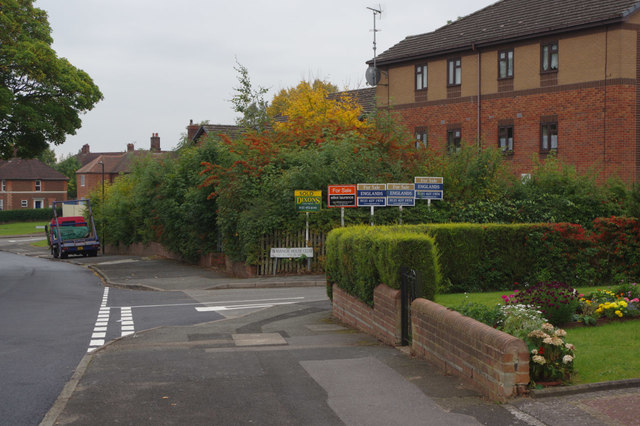
Ilmington Road, Weoley Castle
The road leading off to the right is Manor House Close. The building with the forest of estate agents' signs is Honnington House, sheltered accommodation for older people. It was built in 1991, a notable contrast from the 1930s local authority houses surrounding it.
 Map © Crown Copyright")
TIP: Click the map for more Large scale mapping
- Grid Square
- SP0182, 19 images (more nearby 🔍)
- Photographer
- Stephen McKay (more nearby)
- Date Taken
- Saturday, 3 October, 2015 (more nearby)
- Submitted
- Sunday, 11 October, 2015
- Subject Location
-
OSGB36:
 SP 0187 8210 [10m precision]
WGS84: 52:26.2122N 1:58.4352W - Camera Location
-
OSGB36: SP 0187 8214
- View Direction
- SOUTH (about 180 degrees)