2015
NZ1986 : Ordnance Survey Cut Mark
taken 9 years ago, near to Morpeth, Northumberland, England
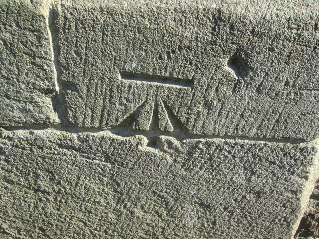
Ordnance Survey Cut Mark
This OS cut mark can be found on the west face of St Robert's Church. It marks a point 28.575m above mean sea level.
 Map © Crown Copyright")
TIP: Click the map for more Large scale mapping
- Grid Square
- NZ1986, 145 images (more nearby 🔍)
- Photographer
- Adrian Dust (more nearby)
- Date Taken
- Friday, 2 October, 2015 (more nearby)
- Submitted
- Wednesday, 14 October, 2015
- Subject Location
-
OSGB36:
 NZ 1967 8603 [10m precision]
WGS84: 55:10.0917N 1:41.5657W - Camera Location
-
OSGB36: NZ 1967 8603
- View Direction
- EAST (about 90 degrees)