2015
SJ8152 : Lane junction near Dunkirk
taken 8 years ago, near to Talke, Staffordshire, England
This is 1 of 2 images, with title Lane junction near Dunkirk in this square
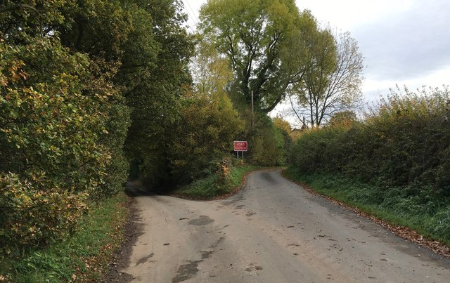
Lane junction near Dunkirk
The lane on the left continues to the hamlet of Dunkirk. The lane on the right suffered subsidence, became impassable and has been permanently closed. The other end, where it emerges onto Bignall End Road, can be seen in Link .
 Map © Crown Copyright")
TIP: Click the map for more Large scale mapping
- Grid Square
- SJ8152, 35 images (more nearby 🔍)
- Photographer
- Jonathan Hutchins (more nearby)
- Date Taken
- Sunday, 25 October, 2015 (more nearby)
- Submitted
- Sunday, 25 October, 2015
- Subject Location
-
OSGB36:
 SJ 8106 5258 [10m precision]
WGS84: 53:4.2070N 2:17.0474W - Camera Location
-
OSGB36: SJ 81026 52586
- View Direction
- EAST (about 90 degrees)